In a recent systematic review published in the International Journal of Environmental Research and Public Health, researchers examined the use of geospatial tools, methods, and techniques such as satellite imaging and remote sensing in analyzing the transmission and mortality rates during the coronavirus disease 2019 (COVID-19) pandemic.

Background
The etiological agent of COVID-19, severe acute respiratory syndrome coronavirus 2 (SARS-CoV-2), emerged in Wuhan, China, in late 2019 and rapidly spread worldwide, causing unprecedented deaths and severe illness.
Recent statistics indicate that the pandemic claimed over 6.87 million worldwide, while 675 million people are reported to have been infected. The pandemic also caused serious socio-economic and public health impacts, with most countries enforcing lockdowns and social distancing measures to limit the spread of the virus. COVID-19 and associated social changes have also altered the environment significantly.
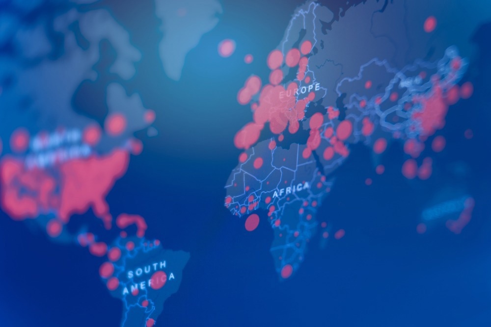
The use of geospatial analyses, satellite imaging, and remote sensing tools can help in tracking the spread of confirmed COVID-19 cases in real-time, analyzing hot spots, and conducting contact tracing.
Geographic information systems (GIS) and geospatial analyses have been used to evaluate public health-related events before the onset of the COVID-19 pandemic. Furthermore, the World Health Organization (WHO) and other organizations, including John Hopkins University, have used satellite imaging and geospatial and remote sensing tools during the COVID-19 pandemic to assess the spread of the virus.
About the study
In the present study, the researchers systematically reviewed current literature on using geospatial analyses, satellite imaging, and remote sensing tools to assess COVID-19 severity and spread. They included studies that used satellite imaging, remote sensing, or geospatial data and examined COVID-19 as an outcome or one of the dependent variables in the study.
Studies that evaluated the effect of COVID-19 on other factors, such as air quality, pollution levels, or the environment, were excluded. Observational and self-report studies were included in the review, but literature such as book chapters, short surveys, conference papers and reviews, editorials, etc., were excluded.
Results
The review included nine studies that used geospatial analyses, satellite imaging, and remote sensing tools to evaluate outcomes associated with COVID-19, and these studies were from countries across the world, including Somalia, Ecuador, India, China, the United States (U.S.), Europe, Indonesia, and Iran. While some used only satellite imaging data or remote sensing data, three studies used a combination of satellite imaging, remote sensing data, and spatiotemporal data to understand the geospatial distribution patterns of the spread of COVID-19.
Spatial and temporal effects and remote sensing data were also used to analyze how the number of COVID-19 cases and associated mortality varied across space and time. A few studies also used geospatial techniques, remote sensing tools, and satellite imaging to simulate COVID-19-related patterns to make predictions about the spread and severity.
Studies from wealthier countries such as the U.S. and European nations were larger in scale, covering broader geographic areas and involving significantly higher amounts of publicly available data on COVID-19 cases. One study involved analyses on a continental scale, covering multiple countries and states.
In contrast, studies from countries such as Iran, Syria, and Somalia, limited by costs, restricted access, an absence of data, and technological constraints, covered smaller geographical areas such as single cities. Furthermore, the under-reported number of confirmed COVID-19 cases and associated mortality, particularly from low-income and underdeveloped regions, presented a major challenge.
The authors believe that while geospatial analyses and remote sensing tools can be improved to address various other research questions, the use of these technologies to deliver digital interventions to target populations might take longer to develop. The use of various data sources to collate and analyze data could help expand the use of geospatial tools and remote sensing techniques in other public health-related events. Understanding disease outbreaks and community transmission patterns can be accelerated using geospatial tools, helping epidemiologists make informed decisions faster.
Conclusions
Overall, this systematic review suggested that while studies have used geospatial tools and satellite imaging and remote sensing data in understanding and assessing the spread and severity of COVID-19, the lack of data, resources, and funds continue to limit the scope of geospatial analyses in evaluating public-health related problems.
The authors believe that collaborations and sharing of data, expertise and technologies can significantly expand the use of geospatial techniques and remote sensing tools in improving the research on public health issues.
- Dahu, B. et al. (2023) "The Role of Remote Sensing and Geospatial Analysis for Understanding COVID-19 Population Severity: A Systematic Review", International Journal of Environmental Research and Public Health, 20(5), p. 4298. doi: 10.3390/ijerph20054298. https://www.mdpi.com/1660-4601/20/5/4298
Posted in: Medical Science News | Medical Research News | Disease/Infection News
Tags: Coronavirus, Coronavirus Disease COVID-19, covid-19, Imaging, Mortality, Pandemic, Pollution, Public Health, Research, Respiratory, SARS, SARS-CoV-2, Severe Acute Respiratory, Severe Acute Respiratory Syndrome, Syndrome, Virus
.jpg)
Written by
Dr. Chinta Sidharthan
Chinta Sidharthan is a writer based in Bangalore, India. Her academic background is in evolutionary biology and genetics, and she has extensive experience in scientific research, teaching, science writing, and herpetology. Chinta holds a Ph.D. in evolutionary biology from the Indian Institute of Science and is passionate about science education, writing, animals, wildlife, and conservation. For her doctoral research, she explored the origins and diversification of blindsnakes in India, as a part of which she did extensive fieldwork in the jungles of southern India. She has received the Canadian Governor General’s bronze medal and Bangalore University gold medal for academic excellence and published her research in high-impact journals.
Source: Read Full Article